A huge winter storm is bringing a lot of new snow to California’s Sierra Nevada mountains this weekend and that is good news for the state’s water supply.
National Weather Service forecasters say some locations could see as much as 12 feet of snow in coming days, likely pushing the state’s below-average snowpack much closer and possibly above average levels.
The storm prompted state officials to do their survey a day early.
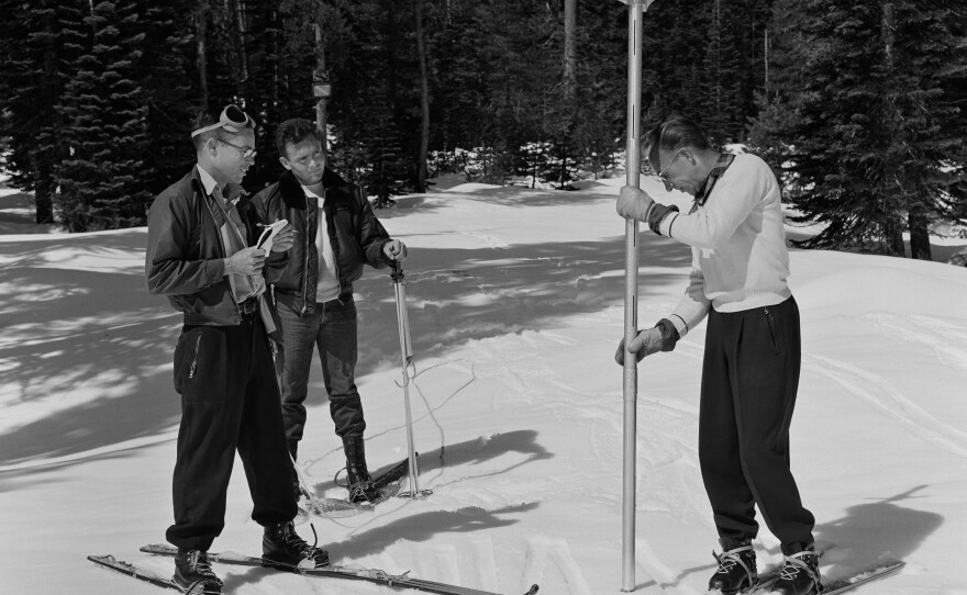
Snowpack measurements taken at Phillips Station near Lake Tahoe on Thursday show the snowpack there is 47.5 inches, nearly 4 feet.
“If you took 48 inches, melted it down, that’s essentially 18 inches of liquid water that we’re standing on right now,” said Andy Reising, a California Department of Water Resources engineer.
That is about 77% of average for March and about 74% of average for April.
“That’s typically when we peak,” Reising said. “Our snowpack builds during December, January, February, March. And then the snow angle, temperatures start to build, the radiation is right and our pack becomes ripe to melt. And that’s when we start seeing a decline in our pack, typically.”
The California Department of Water Resources has been taking snowpack measurements at Phillips Station since 1929.
It is one of about 260 locations where snow is measured to help state officials estimate the amount of snow, and therefore water, stored in the sprawling mountain range.

The California snowpack started this year in an anemic position compared to a year ago.
In January, there were only 7.5 inches of snow at Phillips Station and the snowpack was only 30% of average.
In 2022, that station had 4.5 feet of snow and the snowpack began the year 162% above average.
But water officials say the snowpack has been building regularly since then.
“So far, the storms that have helped build out snowpack have been at an ideal pace that we like to see,” said Angelique Fabbiani-Leon, a California Department of Water Resources engineer. “They’ve been spread out enough to allow for relief of our river systems. This is quite different than last year where we received several atmospheric rivers back-to-back, which ultimately caused flooding impacts across the state.”
Stormy weather since the first of the year boosted the entire Sierra snowpack to about 70% of the peak April average.
But even the impending winter weather will not be enough to make up for the deficit.
“It will take several additional storms within the month of March to really get us from the current 70% of April 1 average up to 100% of average by the first of April,” Fabbiani-Leon said.
The snowpack is closely watched in California because it provides about one-third of the state’s drinking water and the snow fills reservoirs as it melts throughout the year.
State officials said the current reservoir levels in California are 118% of average.


