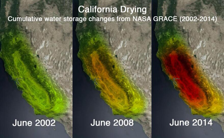
New satellite photos show California is drawing down ground water reserves at an alarming rate.
The images come from two satellites that use sensitive tools to measure Earth's gravity. One thing that affects those measurements is the amount of water stored underground in soil or rock.
Jay Famiglietti, a water researcher at UC Irvine, said the images released by NASA this week, show a significant decline in the state's groundwater.
"It is our strategic reserve. It's our money in the bank. And right now the state is getting 70 percent or more of its water from ground water," Famiglietti said. "We have to preserve it for the long run. So that we can get through the next drought, and the next drought and the one after that."
Famiglietti said up to 4 trillion gallons a year are being drawn out of the Sacramento and San Joaquin River basins alone. That's more water than all the state's residents use in a year.


