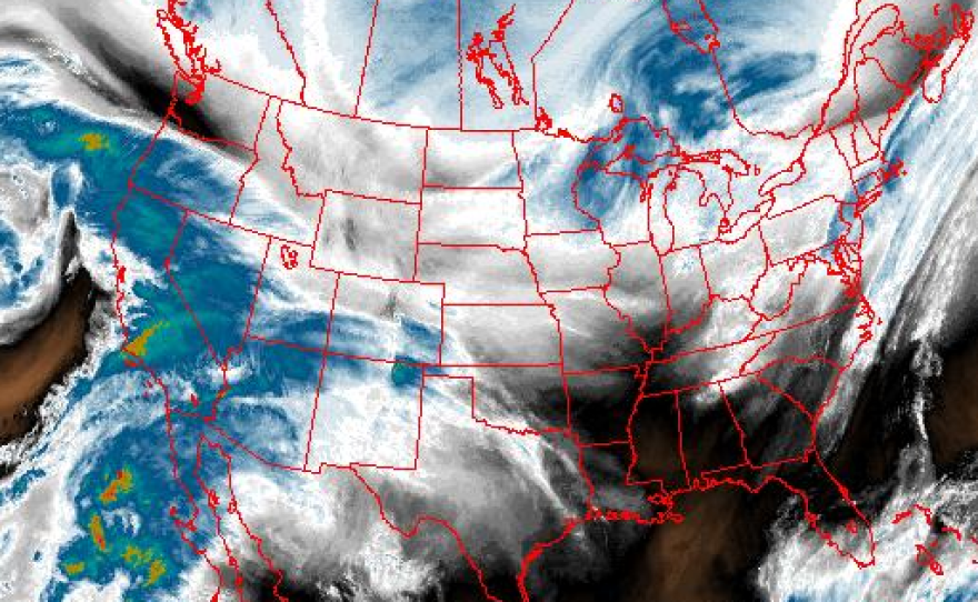
A significant rain storm moving into drought-parched San Diego County on Tuesday is expected to bring heavy downpours, mud and debris flows and widespread street flooding.
Rainfall totals will range from 1.5 to 2 inches along the coast and inland valleys, and 5 to 6 inches in the mountains, according to the National Weather Service (NWS). The bulk of the rain will fall within a 12-hour period, beginning Tuesday afternoon.
“A big corridor of water vapor, some moisture in the atmosphere, is taking dead aim at Southern California,” said Mark Moede, meteorologist with the NWS.
The incoming weather system is a rare atmospheric river storm, which is like a conveyer belt of moisture from the subtropics. It could cause flash flooding, Moede said.

“The greatest chances for flooding are in the mountains,” he said. “They’re going to get the most rainfall. But even coastal and valley zones could see areas of flash flooding and street flooding."
The National Weather Service issued a flash flood watch for most of San Diego County from 9 a.m. Tuesday through Wednesday morning.
Moede said burn areas from the May wildfires, including the Cocos fire in San Marcos, are also at high risk of mud and debris flows.
“It takes a lot less rain in those burn areas to produce flooding,” he said. “A quarter of an inch in an hour could be enough to generate some mud and debris flows in those burn areas."
City of San Marcos officials were closely monitoring the situation, but were not asking residents in recent burn areas to voluntarily evacuate, according to a city spokesperson.
The San Diego River is expected to crest just over 8 feet on Wednesday morning, after the heavy rain has moved through, said NWS meteorologist Alex Tardy.
The incoming system will bring much needed water to the drought-ridden region. Since Jan. 1, Lindbergh Field has received a little more than 3 inches of rain, which is 5 1/2 inches below average.
Ahead of the storm, San Diego County was offering free sand and bags to people living in unincorporated areas to help protect homes, neighborhoods and streets from flooding and soil erosion problems. Residents were asked to bring their own shovel to the distribution sites:
- Cal Fire Station 73: 28205 N. Lake Wohlford Road, Valley Center
- Pauma Valley-Rincon, Cal Fire Station 70: 16971 state Route 76
- Valley Center Cal Fire Station 50: 1587 state Route 78, Julian
- Alpine Fire Protection District, Station 17: 1364 Tavern Road, Alpine (bags only)
- Ramona Station: 3410 Dye Road, Ramona
- North County Fire Protection District, Station 4: 4375 Pala Mesa Drive, Fallbrook
- Cal Fire Station 30: 17304 Highway 94, Dulzura
- Bonita/Sunnyside Fire Department: 4900 Bonita Road, Bonita


